We mapped New York's subterranean tunnels with original illustrations.
3 ratings
Your rating:
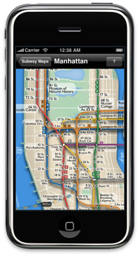
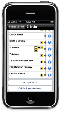
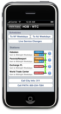
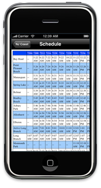
The MTA website is great, but not if you are already underground. We mapped New York's subterranean tunnels with original illustrations, and many users feel they are easier to read than the MTA's own. MAPS INCLUDE: -Manhattan -Brooklyn -Bronx -Queens -Staten Island -PATH -New Jersey Transit -LIRR -Metro North Line info includes: -Station list for each line with connecting train information -Link for each station in list to its location on Google maps -Buttons for live schedule change information (with internet connection) -Buttons to call 311, customer service -Schedules for light rail lines What's unique about our offering: -Only app with maps of ALL light rail lines that go into New York City -Original illustrations (not the same tired MTA maps) -Clear and legible information (no blurry images)

Public Transit
iPhone App
Free
, iPhone
© 2014 Walk Score
Data provided by GTFS Data Exchange![]()
