Find the closest Boston MBTA stop and see where it goes


0 ratings
Your rating:
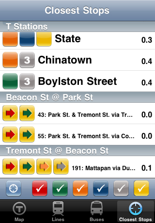
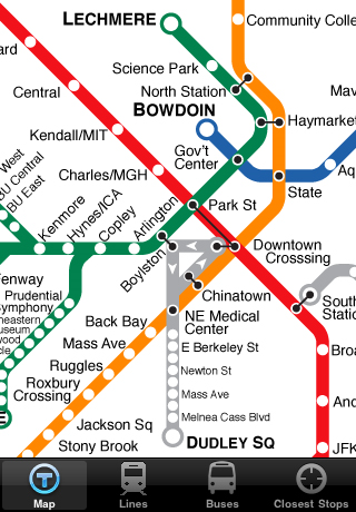
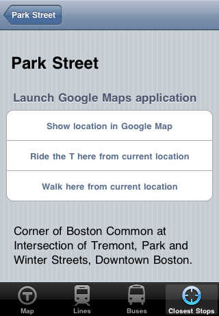
To a T helps you find the closest station or bus stop to your location. Then you can access a map and location information or launch directly into a Google Map with directions of how to walk or ride there from where you are. When looking at the nearest bus stops, the app also tells you at a glance with which lines the bus will connect. Or you can plan ahead and make a connection by seeing all the buses and lines that go through any stop. There is also a zoomable map of the MBTA red, green, blue, orange, and silver lines. Zoom on in and see the all those stops often left off the green line maps. The commuter rail map is on there, too. Maps of the surrounding area for each T station are also available offline.

Public Transit
iPhone App
$2.99
© 2014 Walk Score
Data provided by GTFS Data Exchange![]()
