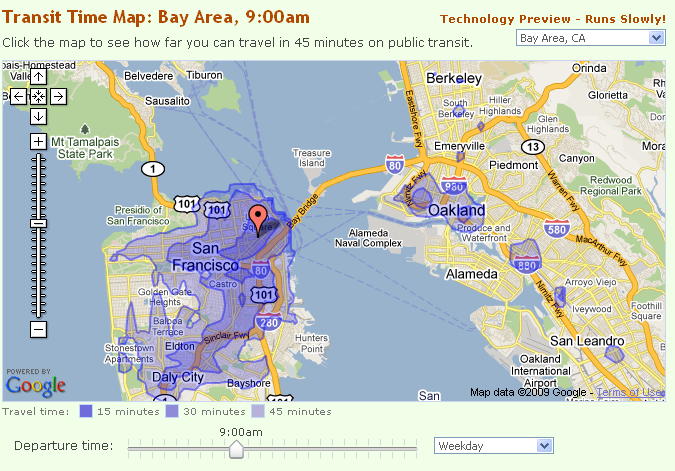
A transit time map shows how far you can travel on public transit from a given location in a certain amount of time.


1 ratings
Your rating:
A transit time map shows how far you can travel on public transit from a given location in a certain amount of time. This map is a baby step towards helping you find a walkable, transit-friendly place to live so that you can ditch the zero (your car) and get with the hero (your new walkable condo near a light rail stop).

Public Transit
Web
Free
, Web
© 2014 Walk Score
Data provided by GTFS Data Exchange![]()
