Personal and precise walkability mapping.
9 ratings
Your rating:
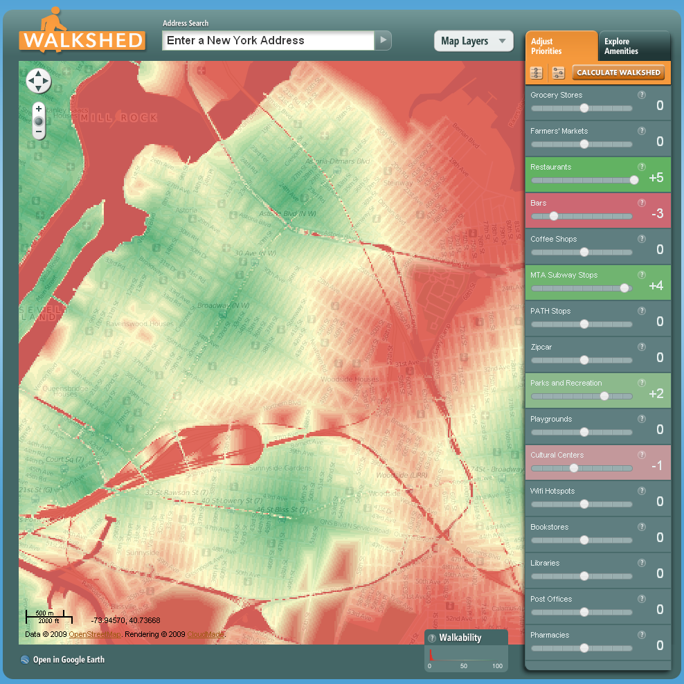
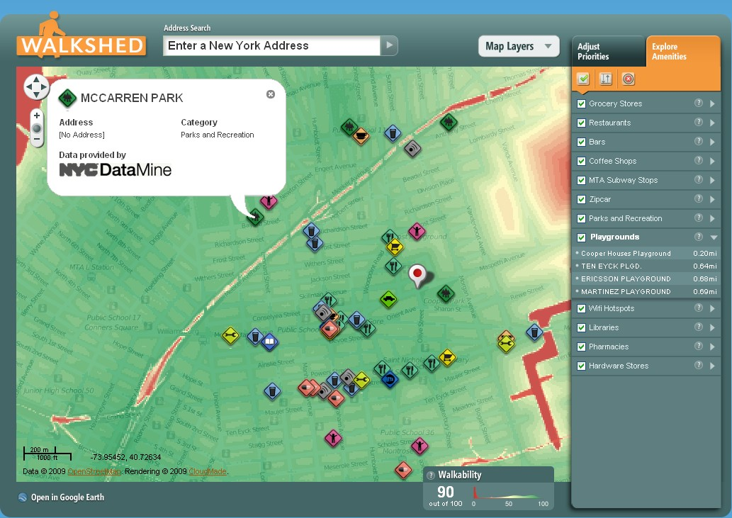
Walkshed generates precise and personal walkability calculations by measuring actual walking distances of the walking amenities that you care most about. Select from a number of priorities, weight them positively or negatively according to your preferences, and generate a custom walkability map. In the process, discover nearby amenities and businesses and how your neighborhood stacks up to others within your city. Walkability means different things to different people. Empty nesters may enjoy being near a wide variety of restaurants and theaters. Runners and families might prefer easy access to parks and playgrounds. Young professionals and students may like the nightlife in certain neighborhoods. All of these people love and value walkability, but they all have different preferences that shape it. Walkshed enables you to find your own walkable way through the urban jungle.

Public Transit, Walking
Website (Desktop/Laptop)
Free
walking, sustainability, transit, walkability, city planning
© 2014 Walk Score
Data provided by GTFS Data Exchange![]()
