Find the closest NYC subway station and walking directions.
3 ratings
Your rating:
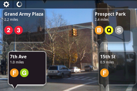
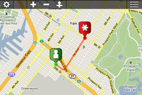
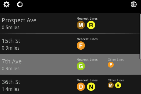
Way to go! Wayfinder, NYC's augmented reality app, is designed to help locate the subway line nearest you. Just point your phone to the street to view the closest train stations. Click a station of your choice to get walking directions in the map view. Point your phone to the ground to check the map view or station list view. Wayfinder, helping you find your way!

Public Transit, Walking
Android App
$1.99
Android, mta subway nyc walking augmented_reality
© 2014 Walk Score
Data provided by GTFS Data Exchange![]()
